This page links to historical maps of Mt Albert held in various online collections, in date order (earliest first).
Click the maps to view the original images. This will allow you to zoom in to see details.
Many of these maps also show the wider Auckland area, but the main criteria for inclusion on this page is usefulness for research about the history of Mt Albert.
Do you know of any other maps that we could include on this page, or have any feedback? Please let us know.
Useful maps for research
Related pages:
- MAPS OF MT ALBERT SUBDIVISIONS (public but incomplete)
- AERIAL PHOTOGRAPHS OF MT ALBERT (still under wraps)
1841 Map of the Harbour of Waitemata, New Zealand…Shewing the Situation of Auckland

Map of the Harbour of Waitemata… shewing the Situation of Auckland (1841, Facsim). [Auckland Museum G9082.W324] Note the high resolution image is no longer online (March 2026)
1850 Map of the Auckland District

Detail from: Map of the Auckland District. (c1850 – date uncertain). [Auckland Libraries Heritage Collections Map 4296]
1850 Titirangi

Titirangi. (c1850 – date uncertain). [Auckland Libraries Heritage Collections Map 4178]
1859 The Isthmus of Auckland with its Extinct Volcanoes by Dr Ferdinand von Hochstetter

The isthmus of Auckland with its extinct volcanoes by Dr Ferdinand von Hochstetter (1859). [Auckland Libraries Heritage Collections Map 5694b]
1867 Map of the City of Auckland & Suburbs, J Evans & Co.
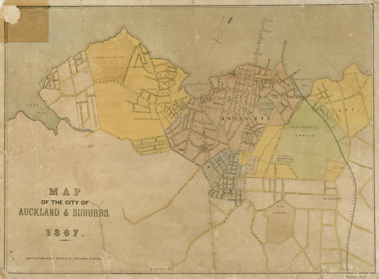
Map of the City of Auckland & Suburbs, J Evans & Co. (1867). [Auckland Libraries Heritage Map 4610].
This map shows the route of Great North Rd and names Morningside 2 years after it was subdivided.
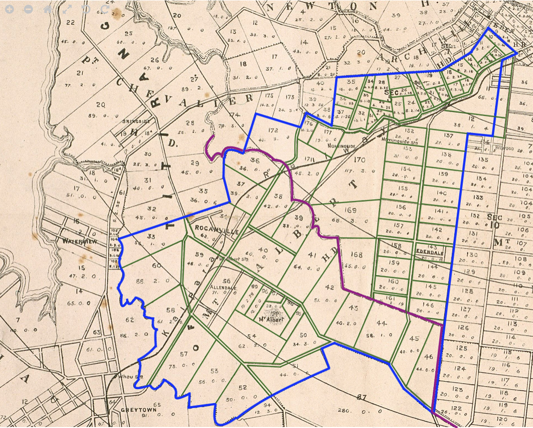
1880 Champtaloup and Cooper’s map of the County of Eden, revised by C. Palmer

Champtaloup and Cooper’s Map of the county of Eden, revised by C. Palmer. (c1880) Champtaloup and Cooper. [Auckland Libraries Heritage Collections Map 190]
For research purposes, we have annotated a detail of this map to clearly show the outline of the Mt Albert Road Board area (blue line), the boundary between Titirangi and Waitemata Parishes (purple line) and the Lot boundaries (green lines). Lot numbers are clearly marked. Click here, or on the map, to see a higher resolution view.
1886 Upton & Co’s New Map of the City and Suburbs of Auckland

Upton & Cos New Map of the City and Suburbs of Auckland. (1886) Wilsons & Horton. [Auckland Libraries Heritage Collections Map 198]
1892 Map of Eden County Shewing Original Sections and Subdivisions Thereof: Sheets 1 and 2


Map of Eden County shewing original sections and subdivisions thereof. Sheet 1 (top) and Sheet 2 (bottom). (1892). New Zealand Department of Lands and Surveys. [Auckland Libraries Heritage Collections Maps 4785 & 4786]
1900 Map of Eden County Shewing Original Sections and Subdivisions Thereof

Map of Eden County shewing original sections and subdivisions thereof. (1900). New Zealand Department of Lands and Survey. [Auckland Libraries Heritage Collections Map 4662]
1900 Upton & Co’s New Map of the City and Suburbs of Auckland. Enlarged and Revised

Upton & Cos New Map of the City and Suburbs of Auckland – Enlarged and revised. (1900) Wilsons & Horton. [Auckland Libraries Heritage Collections Map 6618]
1901 Cleave’s Streets Map of the City and Suburbs of Auckland

Cleave’s streets map of the city and suburbs of Auckland (1901). Cleave’s Directories. [Auckland Libraries Heritage Collections Map 51]
1914 Map of Eden County Shewing Original Sections and Subdivisions Thereof. [Sewer Lines Added. Mt Albert in yellow]

Map of Eden County showing original sections and subdivisions thereof. (1914). New Zealand Department of Lands and Survey. [Auckland Libraries Heritage Collections Map 4661]
1917 Street Map of the City and Suburbs of Auckland Compiled from the Latest Information

Street Map of the City and Suburbs of Auckland Compiled from the Latest Information (1917). Upton & Co. [Auckland Libraries Heritage Collections Map 3115]
1924 Auckland and Environs: Sheets no 4 & 7


Auckland and environs: Sheet No 4 (1924). New Zealand Department of Lands and Survey. [Auckland Libraries Heritage Collections Maps 77 & 79]
1925 Cleave’s Streets Map of the City and Suburbs of Auckland

Cleave’s streets map of the city and suburbs of Auckland (1925). Cleave’s Directories. [Auckland Libraries Heritage Collections Map 48]
1930 Leighton’s Street Map of Auckland City and Suburbs

Leighton’s Street Map of Auckland City and Suburbs (c1930 – date approximate). [Auckland Libraries Heritage Collections Map 6409]
1940 Auckland City Council: Map of City of Auckland and Adjoining Districts

Auckland City Council: Map of the City of Auckland and Adjoining Districts. (1940). Auckland City Council. [Auckland Libraries Heritage Collections Map 8217]
1940 Titirangi

Titirangi. (c1940 – date approximate). [Auckland Libraries Heritage Collections Map 2258]
1946 Mt Albert Electorate Boundaries Map
(note the base map is from 1924 – see above)
Mt Albert Electorate Map (1946). [AADS 27190 W4001 R26340669 Archives New Zealand Te Rua Mahara o te Kāwanatanga Wellington.] [Photographic copy held in MAHS collection]
1947 Whitcombe’s map of Auckland City and suburbs

Whitcombe’s map of Auckland City and suburbs (1947 – date deduced because of WWII street names in Panmure). [Auckland Libraries Heritage Collections Map 2447]
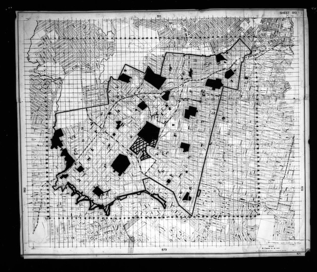
1947 City of Auckland and Environs

City of Auckland and Environs: Index to Aerial Photographs (1947). Auckland City Council. [Auckland Libraries Heritage Collections 580-ALB22-001]
1948 Auckland City and Suburbs

Auckland City and Suburbs (1948). New Zealand Post and Telegraph Department. [Auckland Libraries Heritage Collections Map 2667]
1950 Auckland City Council Planning Map, Sheet 2C

Auckland City Council planning map Sheet no 2C (1950). Auckland City Council. [Auckland Libraries Heritage Collections Map 3501]
1950 Auckland City Council Planning Map, Sheet 3B
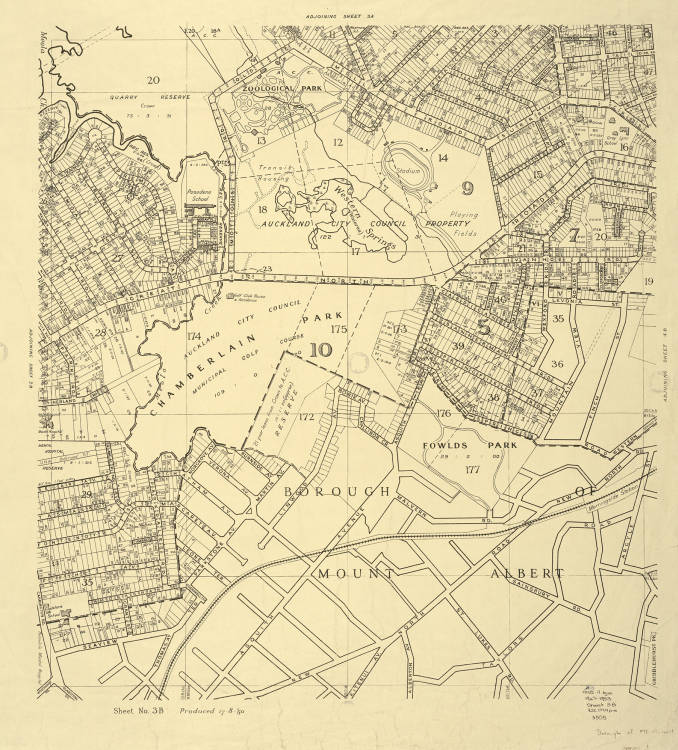
Auckland City Council planning map Sheet no 3B (1950). Auckland City Council. [Auckland Libraries Heritage Collections Map 3505]
1950 Auckland City Council Planning Map, Sheet 4B
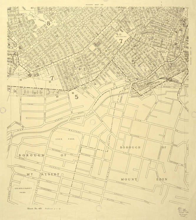
Auckland City Council planning map Sheet no 4B (1950). Auckland City Council. [Auckland Libraries Heritage Collections Map 3507]
1950 Auckland City Council Planning Map, Sheet 4B1
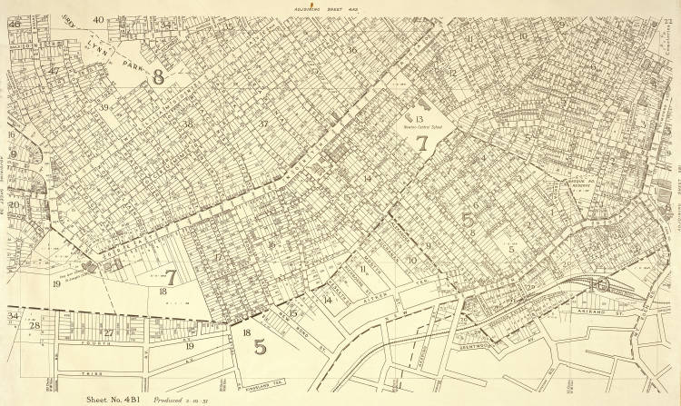
Auckland City Council planning map Sheet no 4B1 (1950). Auckland City Council. [Auckland Libraries Heritage Collections Map 3927]
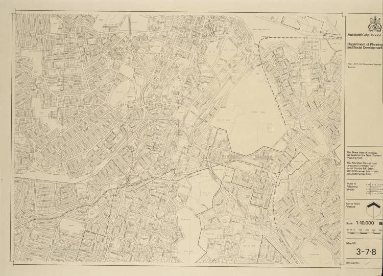
1951 Auckland City Council Planning Map, Sheet 3D

Auckland City Council planning map Sheet no 3D (1951). Auckland City Council. [Auckland Libraries Heritage Collections Map 3506]
1957 Map of Auckland and Environs

Map of Auckland and Environs (1957). New Zealand Department of Lands and Survey. [Auckland Libraries Heritage Collections Map 9316]
1962 Map of Auckland and Environs

Map of Auckland and Environs (1962). New Zealand Department of Lands and Survey. [Auckland Libraries Heritage Collections Map 407]
1967 City of Auckland and Environs [central]

Detail of City of Auckland and environs [central] (1967). New Zealand Department of Lands and Survey. [Auckland Libraries Heritage Collections Map 1078]
1968 Map of Auckland

Map of Auckland (1968). New Zealand Department of Lands and Survey. New Zealand Mapping Service. NZMS 17. [Auckland Libraries Heritage Collections Map 4862]
1970 Map of Sandringham and Mount Albert, showing parks
Map of Sandringham and Mt Albert, Showing Parks [1970]. Auckland Regional Authority Planning Division. [University of Auckland Audiovisual Department]
1970 Auckland Central
Auckland Central (1970). Auckland City Council. [Auckland Libraries Heritage Collections Map 5980]
1979 City of Mount Albert – District Scheme Second Review

City of Mount Albert DIstrict Scheme Second Review (1979). Mount Albert City Council. [Kerr Taylor Foundation website]
1979 City of Mount Albert – Uncoloured Map
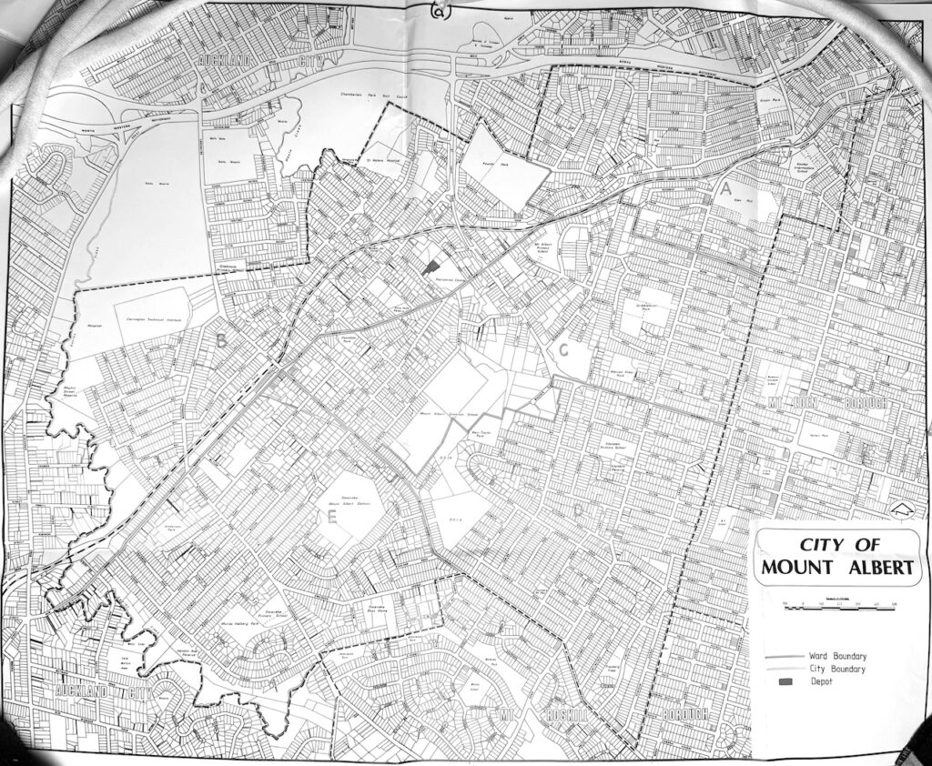
City of Mt Albert Map (c1979). [AANX 7536 W5027 R1144902 Archives New Zealand Te Rua Mahara o te Kāwanatanga Wellington.] [Photographic copy held in MAHS collection]
1983 Mt Albert Ward Map
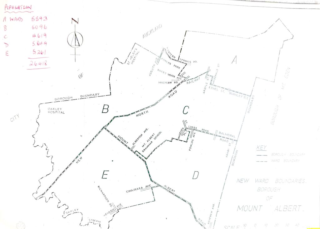
Mt Albert City Council Ward Map (1983). [AANX 7536 W5027 R1144902 Archives New Zealand Te Rua Mahara o te Kāwanatanga Wellington.] [Photographic copy held in MAHS collection]
1989 Auckland City – Wards

Auckland City Wards (1989). [Auckland Libraries Heritage Collections Map 6662]
2011 Auckland Postcode Boundaries
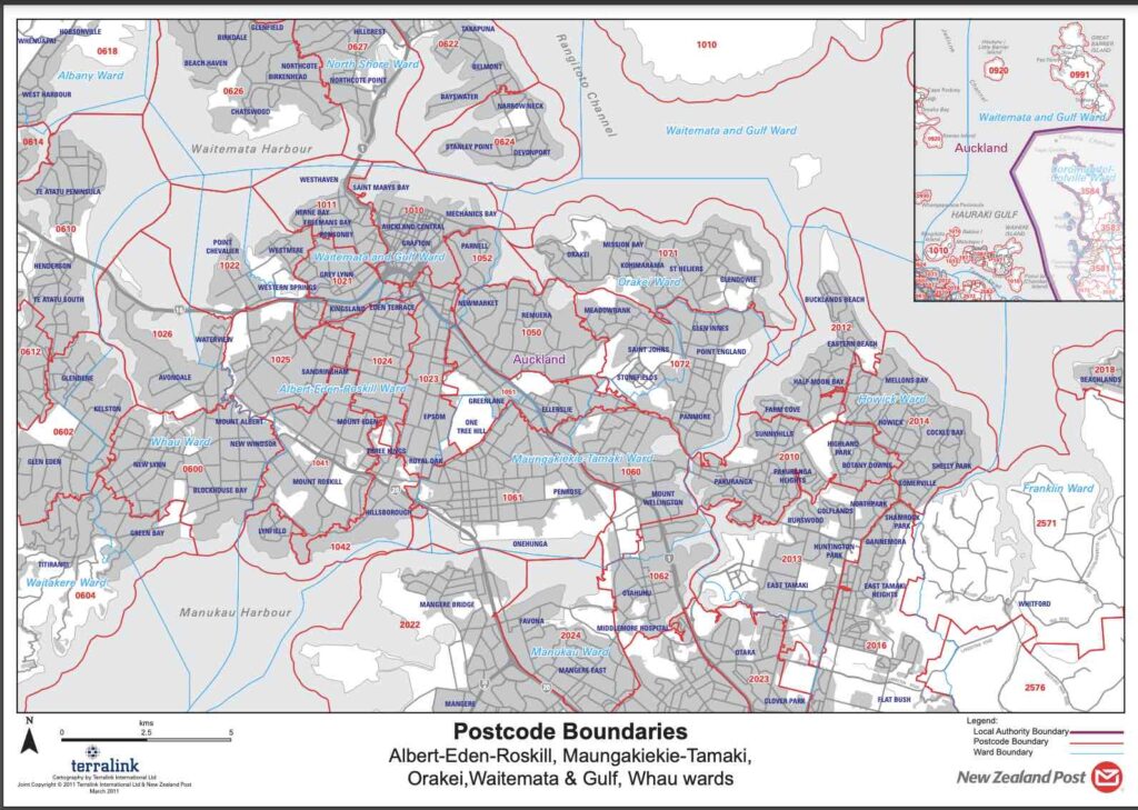
Postcode Boundaries: Albert-Eden-Roskill, Maungakiekie-Tamaki, Orakei, Waitemata & Gulf, Whau wards. (March 2011). New Zealand Post & Terralink.
2020 Electorate Boundaries

2020 General Election Electorates. (2020). Electoral Commission. (note the website will update for future elections)
Current information: Auckland Council GeoMaps Mapping Service
Use the GeoMaps Mapping Service to view current information about the area covered by Auckland Council.
Historical aerial photographs (back to 1940) are also available.
A series of Guides to using the service can be found on its home page.
Current information: Isthmus District Planning Maps Street Index
Pdf maps of every street in Auckland. These are the maps formerly used by Council.
Current information: Google Maps and Google Street View
Use Google Maps to view current street maps and aerial photographs. Change between map and aerial photo view by clicking on the Layers button.
Google Street View provides street level photographs of almost all Mt Albert streets. This can be accessed either by searching for an address, then clicking the photograph of the property in the left hand box, or by dragging the “yellow man” to a location on the map.
Google Street View photographs of Mt Albert were first taken in 2008, and there have been several sets taken since then. These older photographs can be accessed on a computer by clicking on the “clockface “see more dates” link under the street address in the black box on the upper left corner of the screen.
Current information: Auckland Transport Journey Planner

Current information: Statistics NZ Geographic Boundary Viewer (and other maps)

Geographic boundary viewer. StatsNZ. This website has a wide range of other specialist maps that can be seen here.
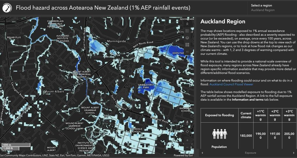
Current information: Auckland Council Flood Viewer
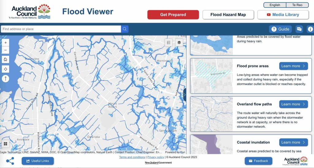
Flood Viewer. Auckland Council.
Current information: NIWA Flood Hazard Map